Walk start: Northton road end
Distance:7km return
Ascent: 360metres. Time taken: 1hr 15 to the top; 3 hours return including several breaks
Star rating: 5
The mini mountain of Ceapabhal is far seen and rears above a ring of three beautiful beaches, each the colour of clotted cream. In fact, for sheer variety and stunning views to islands and coast, ocean and mountains, Ceapabhal is an absolute cracker of a hill, one of the very best and its summit always feel like such a life affirming place to be. That said, my heart is in the Hebrides and it always feels like the islands’ small hills (sometimes barely bumps) reward ten times over for the effort involved.That said, Ceapabhal is quite a steep pull up but at least it’s fairly short!
The issue with Ceapabhal – to me anyway who is obsessed with paths – is that the best route up isn’t always obvious.Over thirty years ago( much younger and fitter) I remember simply heading straight up, clutching onto knee deep heather in places as I couldn’t find any trace of a path.Similarly, years later when Chris and I slogged up it, we failed to find anything but an occasional bit of short lived sheep track.But one of the benefits of hill walking being so much more popular today is that paths have developed, albeit sometimes these become unsightly and eroded.Anyway, as we set off in the car from our Shepherd’s Hut accommodation during this November break, there was a bit of a discussion about ‘which route.’
Another reason for the focus on the best way was, we were a sort of ‘reconnaisance’ party for a family holiday booked on Harris next summer. My son and daughter in law are enthusiastic hill walkers but had never been up Ceapabhal.I knew they were already eyeing it up as a good one to do with wee Finlay( nearly 11 months at present) but who would still need to be carried in the backpack baby carrier for some time .I also knew that an ‘easiest’ route up option would also be appreciated. So- I was on a mission!
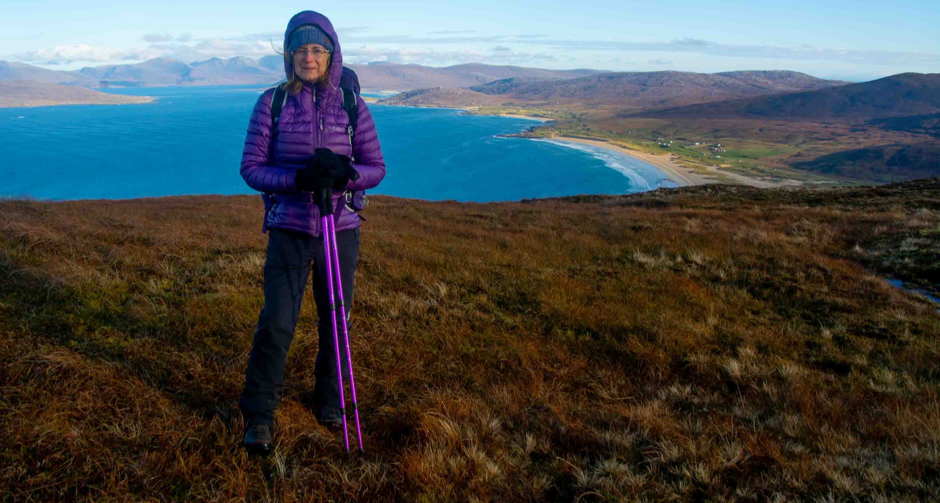
Parked at the end of Northton’s single track road…easily done in winter but it can be difficult to get parked here in summer.The previous day we’d also been here, enjoying the beautiful coastal walk out to ruined Northton Temple, one of my favourite walks in the islands.It had been raining on and off with gloomy skies but the beauty of Harris seems to sing in any weather – I think the island is the most beautiful place I’ve ever been, anywhere.

Start of the walk at the end of the Northton road by Anne C, on Flickr
Today, we decided to approach Ceapabhal via the inland track across the machair which would take us more directly to the walk start. In summer, this huge expanse of grassland is carpeted with wildflowers, heady with scent and creates the finest machair on Harris.No flowers in autumn but still lovely views to the north…

Towards North Harris by Anne C, on Flickr
I was thinking about how different it all looked now (albeit with its own beauty) when my attention was caught by a very large bird high above, its wings flapping almost lazily as it made its way from Ceapabhal in the direction of Northton.

Sea eagle on the path out from Northton by Anne C, on Flickr
Difficult to make out if it was a Golden or Sea Eagle but we both thought the latter on the basis of the sheer hefty size of the wings and what looked like a more vulture-like head/bill (not caught on camera unfortunately. )A juvenile perhaps given there was no white tail?
The Walkhighlands route suggests going as far along the machair track as Traigh na Cleabhaig, the middle of the three gorgeous beaches before the chapel, then accessing the hill via a gate.This seemed further round than where I remembered accessing the hill but Chris reminded me that there is a substantial wall and fencing that would be awkward if not very dodgy to cross; it’s certainly a fence that’s in very good nick and not how it used to be years ago.As we approached an abandoned car (it’s been there for years) I really longed to head up onto the machair as I was sure there was a stile which would let us get onto the hill early doors (turns out there was which we discovered later) but Chris wasn’t keen so we pushed on.
No hardship because the whole area is a delight and sure enough, 15 mins after setting out, the gate appeared just beyond Traigh na Cleabhaig.Now the hard uphill work started!

Above Traigh na Cleabhaig by Anne C, on Flickr
At first, we headed a little back on ourselves as I was keen to intersect – sooner rather than later – with a path marked clearly on the OS map.This led to the summit but started part way up the slopes. Being a bit OCD about paths, if I know they exist (and without one, Ceapabhal can be really hard going , steep and rough with knee deep heather)I get determined to find them
The going was actually quite good initially, as there was plenty of short cropped grass to help avoid the boggy bits.But even better, we came upon the grassy track after barely 5 mins or so!
Although this lower section isn’t shown on the OS map I suppose the hill has become so popular over the years, that the tramping of many feet has created it.This was a real boon and made climbing what in Chris’s words is a steep wee b***er, much easier.

On the lower path already by Anne C, on Flickr

Tawny and gold…looking over Scarista by Anne C, on Flickr
The views back were already stunning, the 16th century ruined chapel suddenly very tiny below us.Some years ago, there was a Neolithic dig going on beside the chapel but I’ve never seen any trace of it since.There was originally an ancient Dun nearby and it is believed that the stones from this were used to build the chapel.

Northton Temple by Anne C, on Flickr
Skye and Torridon were now in view…

Northton , Skye and Torridon beyond by Anne C, on Flickr
It was a lovely path and a huge change from my memories of the hill years back…in fact, a pleasure to hike up….

The path weaving ahead by Anne C, on Flickr
Quite quickly into the climb, St Kilda – Hirta and Boreray – were clear on the western horizon, always a thrill to see.Away to the east, lay Rubh Hunish on Skye and – just – the outline of Neist Pooint.As we got higher, the Cuillin were clear too with the Torridon mountains beyond.

St Kilda and Boreray by Anne C, on Flickr
There’s nothing difficult about Ceapabhal apart from it being a steady if relatively short slog…and the views keep your interest the whole way.They are never short of magnificent.

Steepening a bit… by Anne C, on Flickr

Great wee path by Anne C, on Flickr
I thought the path would dodge the slightly rockier band but it took us swiftly and easily up through it until suddenly, the angle eased off (a bit of a relief) and the terrain changed to boggier moorland as we reached the upper final slopes.

Up through the boulders by Anne C, on Flickr
A golden plover whistled plaintively as we approached the trig point where the views were just outstanding. Beyond it, lay the summit cairn.
To the south lay lovely North Uist with the shapely trio of North Lee , South Lee and Eaval looking really lovely.
The Skye Cuillin were clear to the east and south, here zoomed…

Skye Red and Black Cuillin zoomed by Anne C, on Flickr
The rocky outline of Heisgeir Eagach off North Uist looked very clear…

Heisker Eagach by Anne C, on Flickr
The mountains of North Harris looked majestic across the huge sweep of sand that is Luskentyre.

North Harris by Anne C, on Flickr

To the north from the summit by Anne C, on Flickr

Scarista and south Harris mountains by Anne C, on Flickr
Somehow, my gaze always returned to Maodal and Greabhal looming above the great sweep of the sea inlet and Scarista with Roinebhal as backdrop, as well as, on the far horizon, the Cuillin and Rubh Hunish on Skye.

DSC_0440.jpg by Anne C, on Flickr
The distinctive outline of Neist Point with Dunvegan Head prominent, zoomed…

Neist Point on Skye zoomed by Anne C, on Flickr
Tiny islands to the north capped with a Lighthouse looked as if they might be the Flannan Isles ; although I thought I took photos I couldn’t make them out at all in any of the images.They lie about 20 miles west of Lewis, so given the clarity, it may have been them.
It must have been a brilliant day on the Torridon mountains….Baosbheinn and Beinn Alligin’s distinctive dome are visible here…

Torridon zoomed from the summit by Anne C, on Flickr
Always a thrill to see the St Kilda group…Hirta and Boreray.An unforgettable day trip of a few years back, one which is hard to pull off, given the likelihood of cancellation due to weather/high seas.It took us a couple of attempts over 2 years before we made it and it was touch and go up until the last moment.


Cloud was coming and going on Clisham…another fabulous island viewpoint though I think it’s one of the boggiest starts to a walk I’ve ever experienced! Still, well worth it.

Clisham zoomed by Anne C, on Flickr
Ceapabhal is not an easy summit to leave (well, few are) but I must admit to being particularly partial to a 360 degree view of by ocean, islands and gleaming sands all set off by shapely mountains.
We spent ages on the top, tucked into the cairn out of the chilly breeze, just admiring it all.Being on a summit,even a lowly one like this, is like a drug, I often think.It’s addictive – there’s such a ‘high’ from getting there, that sense of achievement, being stunned by the views, the air, the colours (often the wildlife), the sheer beauty and wonder of it all.
After 40 mins the cold was beginning to seep through ( my nose was definitely turning red in the photo) so it was time to descend.In some ways the vistas were even better going down because there was the visual impact of the steep slope falling away framed by the gorgeous tawny hills and creamy beaches.

Starting to feel chilly at the top by Anne C, on Flickr

Heading down by Anne C, on Flickr
‘Large bird on the left!” Chris said urgently at one point and I looked across to see another eagle sweeping across Ceapabhal’s upper slopes, heading for Northton (it was an odd deja vu moment, a repeat of what we’d seen at the start of the walk, but it was definitely a different bird.) In seconds, it was just a speck but I got one reasonable picture in which a golden head is visible.

Golden eagle on descent by Anne C, on Flickr
As we got nearer where we’d joined the good path on the ascent, I suggested we head straight down instead of making across country to the gate. I was determined to see whether that stile still existed as it seemed unlikely it would just have been done away with – and, there it was! In fact, the path took us pretty much there with a final short section over nice short cropped grass.The little stile was straight ahead in this photo though hard to see; it felt like a minor ‘result’ as Chris, I knew, was sure I was getting it mixed up with another hill.

I spy the stile! by Anne C, on Flickr
Over the stile and onto slightly damper ground, but it soon led to springy machair again.We followed the cut of a little burn down to the machair track (near the abandoned car again) then onto the stunning beach.

Looking back up by Anne C, on Flickr
That beach is such a lovely end to Ceapabhal, not a soul on it today.Even in summer, there never seem to be many people out here.

Nice short grass to the beach by Anne C, on Flickr

Something big broke the sea surface – what was that? A porpoise? No, too close to shore.Then a big Atlantic Grey seal popped its head out of the shallows and had a good look at us as we wandered down to the soft crashing surf.

Atlantic Grey Seal in shallows by Anne C, on Flickr
He (or she) was lolling about in the shallows, so close in that we could see every movement he made under the surface. He must have thought we looked a harmless pair of biddies because he didn’t swim any further out. What a treat!
There was no contest about the return route – it had to be via the beautiful coastal path.

Ceapabhal above the beach by Anne C, on Flickr
We picked up the trail at the end of the beach and followed it up and through a gate, with a final look back at Ceapabhal. It’s really only from the north that the hill’s name – Horse Mountain – is apparent; from that angle its shape does look like the great back of a horse, with the dip where a saddle would go.

Ceapabhal living up to its Gaelic name by Anne C, on Flickr
In November, the colours everywhere are just a treat: tawny, burnt orange, gold and from a distance, an almost purplish hue to the now flowerless remains of the heather.Set against a shimmering blue sea and turquoise shallows, it all looked sublime.

Ist beach on Northton walk by Anne C, on Flickr
On the near horizon is Pabbay, opposite Berneray, an island I’ve always wanted to visit….

A lovely walk along the coast back to the car…

The coastal path by Anne C, on Flickr

DSC_0545.jpg by Anne C, on Flickr
What a joy it was to revisit this magical wee mountain, the haunt of eagles.Hopefully, all things being equal, a return next summer when the machair flowers will add to the scene amidst the emerald greens of high summer.

Gorgeous hike. Thank you Anne. Your info is always gre
LikeLiked by 1 person
Bronna…many thanks! Glad you enjoyed the write up.Anne
LikeLike